The WMPO is proud to launch a Safe Streets and Roads for All (SS4A) Safety Action Plan initiative to improve roadway safety for all roadway users in the region. The SS4A program is a federal initiative launched by the U.S. Department of Transportation to support efforts to enhance transportation network safety and to eliminate serious injuries and fatalities, particularly for people walking, using a mobility device, biking, taking transit–not just those driving. The goal of the WMPO SS4A Safety Action Plan is to develop a holistic, well-defined multimodal strategy to prevent roadway fatalities and serious injuries in the WMPO region.
These plans also incorporate the Safe Systems Approach, which is a holistic, proactive way of thinking about traffic safety. Instead of blaming individual road users for crashes, it focuses on designing a transportation system that protects everyone, even when people make mistakes.
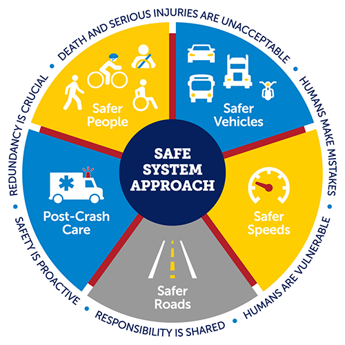
Safe Systems Framework (Source: USDOT)
These plans also incorporate the Safe Systems Approach, which is a holistic, proactive way of thinking about traffic safety. Instead of blaming individual road users for crashes, it focuses on designing a transportation system that protects everyone–even when people make mistakes. Core principles of Safe Systems include safer people, safer roads, safer speeds, safer vehicles, and better post-crash care.
Get Involved
Starting in May 2026, Phase III marks the final round of public engagement, and your chance to help shape the Safety Action Plan before it’s finalized. Join us at upcoming in-person events to review draft recommendations, ask questions, and share your input. Check out the events below and sign up for email updates to stay in the loop.
| EVENT | DATE | TIME | LOCATION |
| River to Sea Expo | May 1 | 3-7 p.m. | Empie Park 3405 Park Ave. |
| Northside Community Dinner | May 14 | 6-8 p.m. | DREAMS Center 901 Fanning St. |
| Disaster Preparedness Expo | May 16 | 11 a.m. – 2 p.m. | Skyline Center 929 N. Front St. |
| Poplar Grove Farmers Market | May 20 | 10 a.m. – 12 p.m. | Poplar Grove Plantation 10200 US HWY 17 |
| Summer Safety Saturday | May 30 | 10 a.m. – 12:30 pm. | Independence Mall 3500 Oleander Dr. |
SS4A Safety Action Plan Timeline

SS4A Safety Action Plan Timeline
The project has several key milestones comprised of both the data-driven technical analysis portion of the project, community engagement, and the final deliverables. This plan will be completed in October 2026.
What is an SS4A Safety Action Plan?
A SS4A Safety Action Plan is a comprehensive strategy that identifies safety issues and outlines actions to improve roadway safety for all users, including pedestrians, bicyclists, and drivers. The SS4A Safety Action Plan typically includes crash data analysis to identify trends and high-risk locations, community engagement to understand local concerns, identification of proven safety countermeasures, and a prioritized list of projects or strategies to eliminate serious crashes and fatalities on our transportation network.
SS4A Safety Action Plan Vision & Goals
A vision and a set of goals have been developed by the project team and local agency staff to help guide the project.
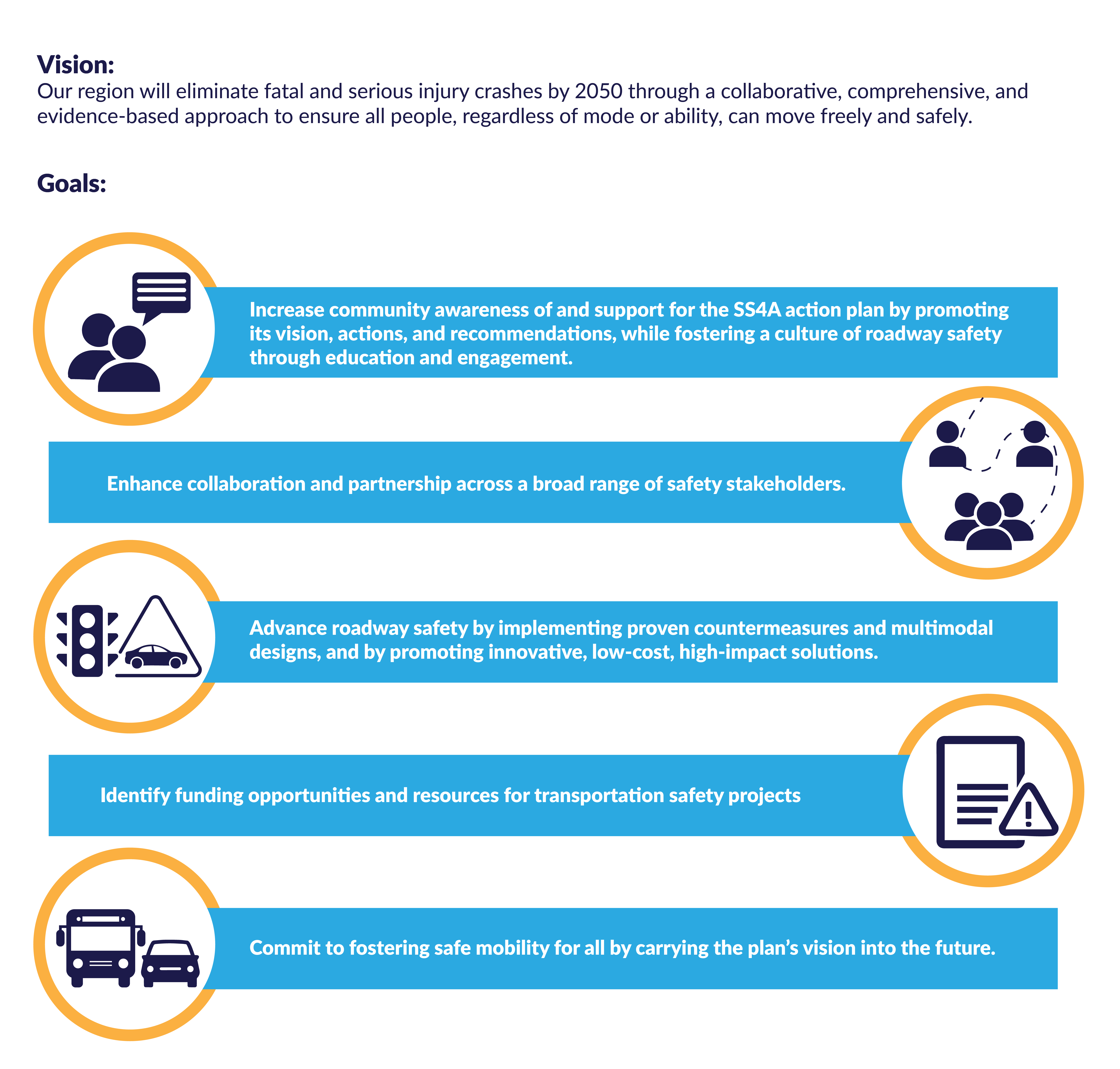
SS4A Safety Action Plan Vision and Goals for the Region
Crash Facts

Crash Facts at a Glance (Source: NCDOT)
Fatal and serious injury crashes are slightly trending up in our region. This plan works to address this critical community issue.

Regional Crash Trends (Source: NCDOT)
ArcGIS Map of the High Injury Network
Phase I Community Engagement
During Phase I of public engagement, we created an online survey and interactive map to gather input for out Safety Action Plan. These tools allowed residents to share their travel habits, safety concerns, and ideas, as well as mark spots on the map where they feel unsafe. This feedback is helping shape strategies and project recommendations in the plan.
A series of engagement pop-ups was also held in August and September 2025 to collect additional community feedback. Phase I has now concluded. Read the summary below for information collected thus far.
Phase II Community Engagement
During Phase II of public engagement, we built on initial feedback by asking the community to help identify intersections and roadways for safety improvements. Participants were also invited to share what safety looks like to them, including the types of countermeasures they would like to see in their neighborhoods. Feedback was collected through an online survey and interactive comment map, helping refine and prioritize strategies and potential projects for the Safety Action Plan.
A series of engagement pop-ups was also held in January and February 2026 to collect additional community feedback. Phase II has now concluded. Read the summary below for information collected thus far.